Highlights of Wakkanai Port North Breakwater Dome
A semi-arch lined with 70 cylindrical pillars
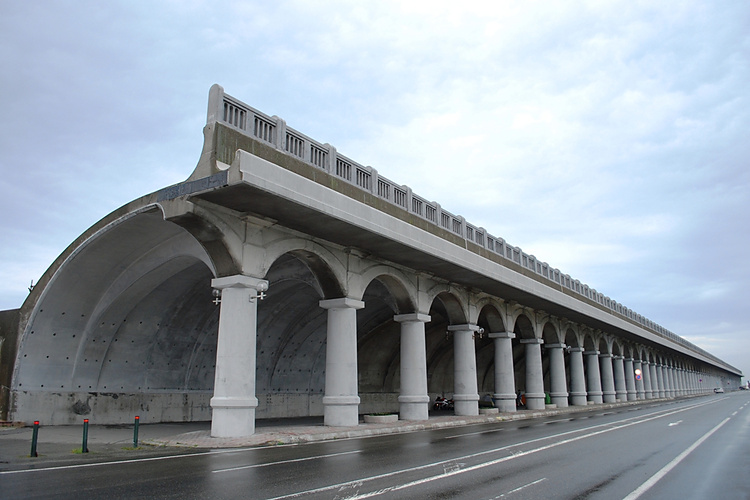 Image: Captain76 / Wikimedia Commons (Public domain, cropped, resized, and sharpened)Wakkanai Port North Breakwater Dome is a massive breakwater measuring 427 m long and 13.6 m high. Its continuous row of 70 columns and semicircular arches evokes ancient Roman architecture, making this practical harbor facility one of Wakkanai’s signature architectural sights. Walking through the colonnade to the far end lets you experience the depth created by the repeating form.
Background to the construction and the designer
Wakkanai Port is vulnerable to strong winds and high waves, so people and cargo once at the quay needed protection from the waves. Construction of the dome began in 1931 and was completed in 1936. The design was handled by the young civil engineer Minoru Tsuchiya, who played a major role in its construction together with Toshio Hirao, head of the Wakkanai Port Construction Office.
Memories of the Chihaku ferry route and railway
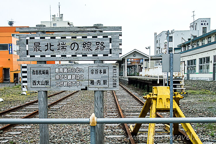
Before the war, the Chihaku sea route operated from Wakkanai Port to Ōtomari on Sakhalin. A railway ran along the dome to Wakkanai Pier Station, which served as a northern gateway where passengers transferred from trains to ships. In 1945, the Chihaku route ended its service, but its remnants still convey the history of the era when the port and railway were connected.
After deteriorating, it was completely restored from 1978 to 1980, returning it to its original form. In 2001, it was designated a Hokkaido Heritage site, and in 2003, it became a Selected Civil Engineering Heritage site recognized by the Japan Society of Civil Engineers. Today, it is used not only for walks but also for events and special lighting.
Basic Information about Wakkanai Port North Breakwater Dome
The information below was checked against official sources on September 21, 2026. Please also check the latest information on the official website when planning your trip.
- 🔗 Official website
- You can check the dome’s structure, the background to its construction, its connection with the Wakkanai–Korsakov route, and the history of its renovations.
 稚内市北海道稚内市の公式ホームページ。まちの話題や市役所からのお知らせなどの市民向け情報の他、観光やイベント、産業などについての情報など。www.city.wakkanai.hokkaido.jp
- 📍 Address
- Kaiun, Wakkanai, Hokkaido
- 🕒 Hours
- The outdoor area can be visited at any time. Follow local restrictions during events or work.
- 🚫 Closing days
- There are no regularly scheduled closing days.
- 💶 Admission
- Free
- ⏱️ Time required
- Allow 20 to 30 minutes to walk along the colonnade and see the structure, or 30 to 45 minutes for a round trip while taking in the harbor views and history.⚠️ The area available for viewing and the length of your visit may change due to restrictions related to events or port operations.
Access to the Wakkanai Port North Breakwater Dome
On foot
It is about a 5-minute walk from JR Wakkanai Station. Head toward the port from the north side of the station. It is an easy stop at the beginning or end of a tour of the city center.
By car
It takes approximately 30 minutes from Wakkanai Airport. As the area around the dome is also a port facility, follow the signs and on-site instructions when stopping or parking, and take care not to obstruct work vehicles.
You can check the location and access information in the official tourist guide published by the Wakkanai Tourism Association.

For attractions, transport and suggested itineraries, see “Wakkanai: A guide to sightseeing spots, food, transportation and sample itineraries”.