Highlights of Makapuu Point Lighthouse Trail
Trail overlooking the lighthouse and east coast
From the parking lot to the viewpoint for Makapuu Point Light, it isabout a 2-hour round-trip hike. The trail is paved but moderately difficult, with a sustained climb of approximately 152 meters.
Below, the sandy beaches and headlands of the east coast stretch from Makapuʻu Beach to Waimānalo Beach.
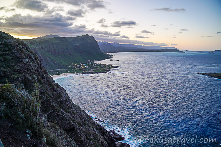
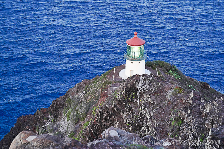
The route follows a former paved road. As you climb, the southeastern coastline of Oahu, Koko Head, and Koko Crater come into view, and the scenery changes into a landscape of sea and rolling dry slopes. From partway up the slope, you can see the offshore islands, and from the viewpoint, look down on the red-roofed lighthouse.
Makapuʻu Lighthouse is a historic lighthouse built in 1909. While the lighthouse itself is not open to visitors, the railed lookout near the summit offers sweeping views of the windward coast and small offshore islands. From November to May, migrating humpback whales can sometimes be seen.
Essential Information for the Makapuʻu Point Lighthouse Trail
The information below was checked against official sources on November 17, 2026. Please also check the latest information on the official website when planning your trip.
- 🔗 Official information
- Hawaii State Parks, part of the Department of Land and Natural Resources, provides information on the trail's distance, difficulty, directions to the parking lot, and highlights.
 Makapuʻu Point Lighthouse TrailTrail Length 2.0 miles (round trip) Activity Pedestrian Difficulty Moderate Terrain Hot, Dry Slopes Elevation Gain ...dlnr.hawaii.gov
- 📍 Location
- Kaiwi State Scenic Shoreline, Kalanianaole Highway(Hwy. 72), Oʻahu, Hawaii, United States
- 💶 Fee
- Use of the trail is free.
- ⏱️ Duration
- Allow about 2 hours for the round trip. ⚠️ This may vary depending on your pace on the slopes, time spent at the lookout, and seasonal whale watching.
Access to Makapuu Point Lighthouse Trail
If driving from the Honolulu area, take H-1 east and continue after it becomes Highway 72, passing Hawaii Kai, Hanauma Bay, and Sandy Beach Park. When you reach the Kaiwi State Scenic Shoreline parking lot along Kalanianaole Highway, follow the signs from the parking lot to the entrance of the paved trail.
From the Kailua or Waimanalo area, travel southeast on Kalanianaole Highway (Hwy. 72), passing Makapuu Beach Park. The park area is on the left where the road begins to climb toward Makapuu Head, and the parking lot connects to the trailhead.
For attractions, transport and suggested itineraries, see “Oahu | A guide to attractions, food, transportation, and a sample itinerary”.